
From field delineation to USACE-ready permit submittal.
The Ecobot for Permitting workflow across wetland and stream delineation and aquatic resources permitting, trusted by over 3,796 scientists and project managers at consultancies, agencies, and the industries they serve across the US. Post-permit monitoring is a separate product, available in private beta.
- 01
Project setup
Spin up a project in Ecobot Manager, configure the survey type (wetlands, streams, or general field observation), invite teammates, and assign roles. Permissions are role-based across Admins, Managers, and Users.
- Configurable survey types
- Role-based permissions
- Team-wide standards from day one
- 02
Field delineation
Ecobot Collector standardizes data capture in the field, vegetation, soils, hydrology, photos, GNSS location, online or off. AI vegetation ID, hydric soil suggestions, and automated calculations cut field time without cutting corners.
- iOS and Android, online or offline
- AI Plant ID and hydric soil suggestions
- Auto location data and structured photos
- 03
QA and assembly
Office teams pick up the data in Ecobot Manager. Survey merge, force check-in, photo editing, map-linked image review, and bulk editing make a deep, structured review surface, the kind permit packages depend on.
- Survey merge and transfer
- Map-linked photo browsing
- Bulk editing across points
- 04
Permit application
Generate consistent USACE-ready documentation across projects, teams, and offices. Customizable photo PDFs, regulatory PDFs, GeoJSON, and shapefile on every plan, geodatabase and CSV exports start on Essential.
- USACE-aligned regulatory PDFs
- GeoJSON + shapefile (all plans); geodatabase + CSV (Essential and above)
- Photo PDF export, summary or detailed
- 05
Post-permit monitoring (separate product)
Private betaWhen permitting wraps, Ecobot for Monitoring picks up the post-permit work as a distinct product on the same Collector + Manager platform. Wetlands monitoring is in private beta; an aquatic resources module is in progress.
- Separate product from Permitting
- Wetlands monitoring in private beta
- Aquatic resources module in progress
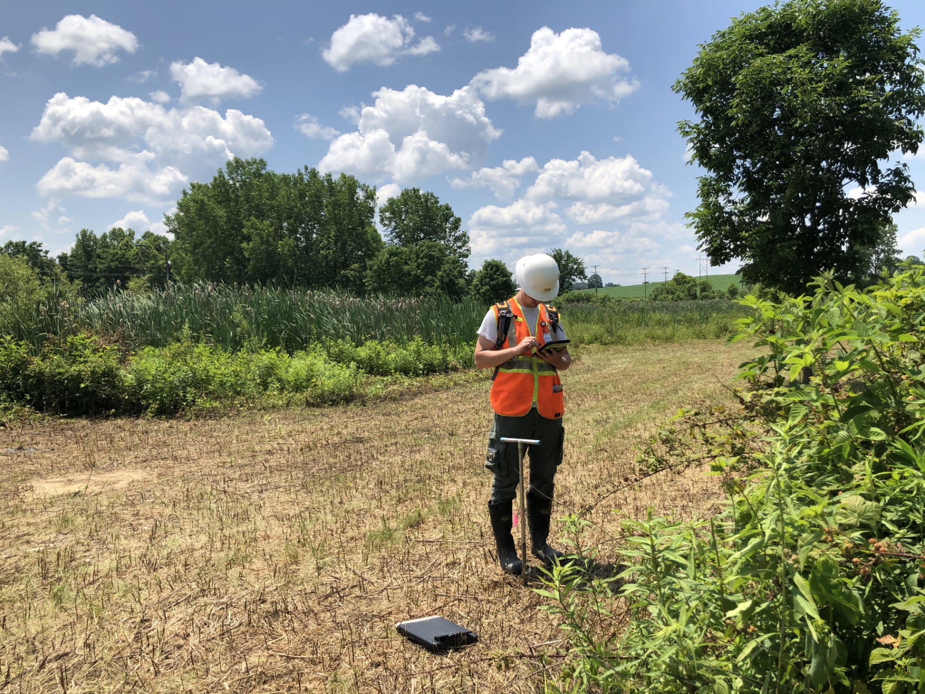
The teams already running this workflow.
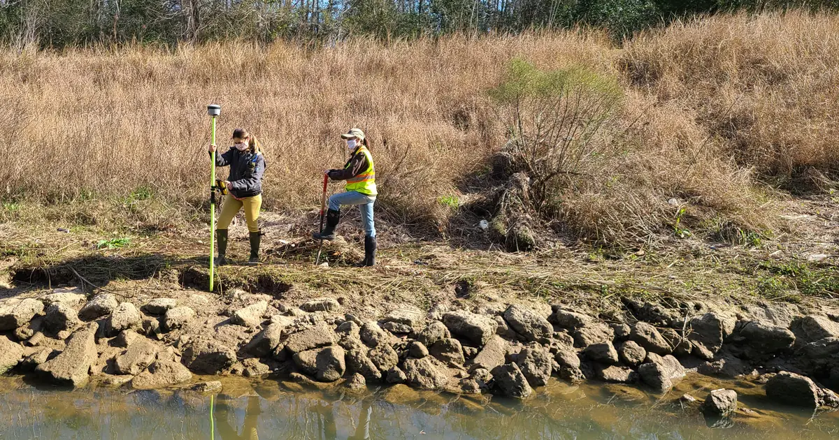
Hollaway cuts wetland assessment time by 50% for a road infrastructure project
Questions teams ask before they switch.
- Does Ecobot work offline in the field?
- Yes. Ecobot Collector captures data, vegetation, soils, hydrology, photos, GNSS location, without cell service, and syncs to Manager when the device reconnects.
- Which USACE regional supplements are supported?
- All nine: Atlantic and Gulf Coastal Plain, Arid West, Eastern Mountains Piedmont, Great Plains, Caribbean Islands, Hawaii and Pacific Islands, Midwest, Northcentral and Northeast, and Western Mountains, Valleys, and Coast. USACE 2024 forms. More detail on the permitting page.
- What exports does Ecobot produce?
- Regulatory PDFs, photo PDFs (summary or detailed), GeoJSON, and shapefile are included on every plan. Geodatabase, CSV, and project-wide species lists are available on Essential and above. As an Esri Partner, GIS outputs drop straight into ArcGIS. See the platform overview.
- Do I have to talk to sales to get started?
- No. Ecobot has a free tier for teams of 1-4 and self-service paid plans, start at the Get Started page or compare tiers on the pricing page. Larger teams can request a custom demo.
- How is monitoring different from permitting?
- They are two distinct products on the same platform. Ecobot for Permitting is commercially available across wetlands and streams today. Ecobot for Monitoring is a separate product, in private beta, wetlands monitoring is in private beta; an aquatic resources module is in progress.
The exact moves teams make every week.
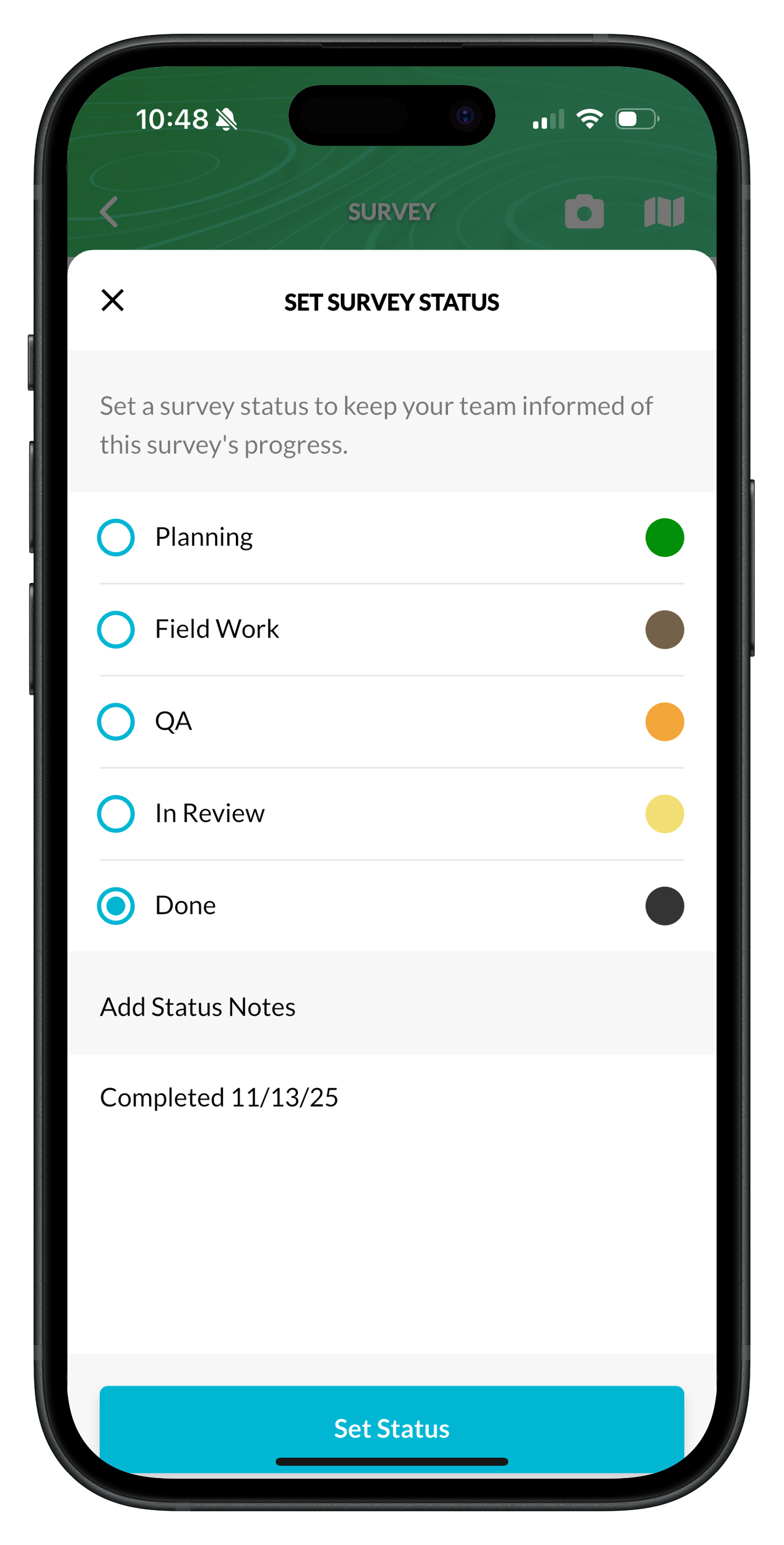
Survey status, color-coded in the field
Set Planning → Field → QA → Done from Collector. PMs see the same status in Manager, no double entry.
Read the how-to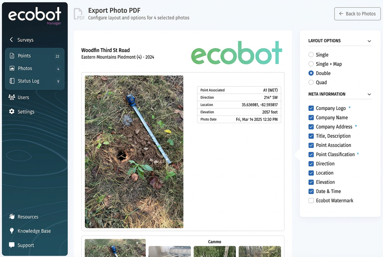
Photo PDFs that look like deliverables
Customize layout, metadata, watermark, and company branding. Saved as your default for next time.
Read the how-to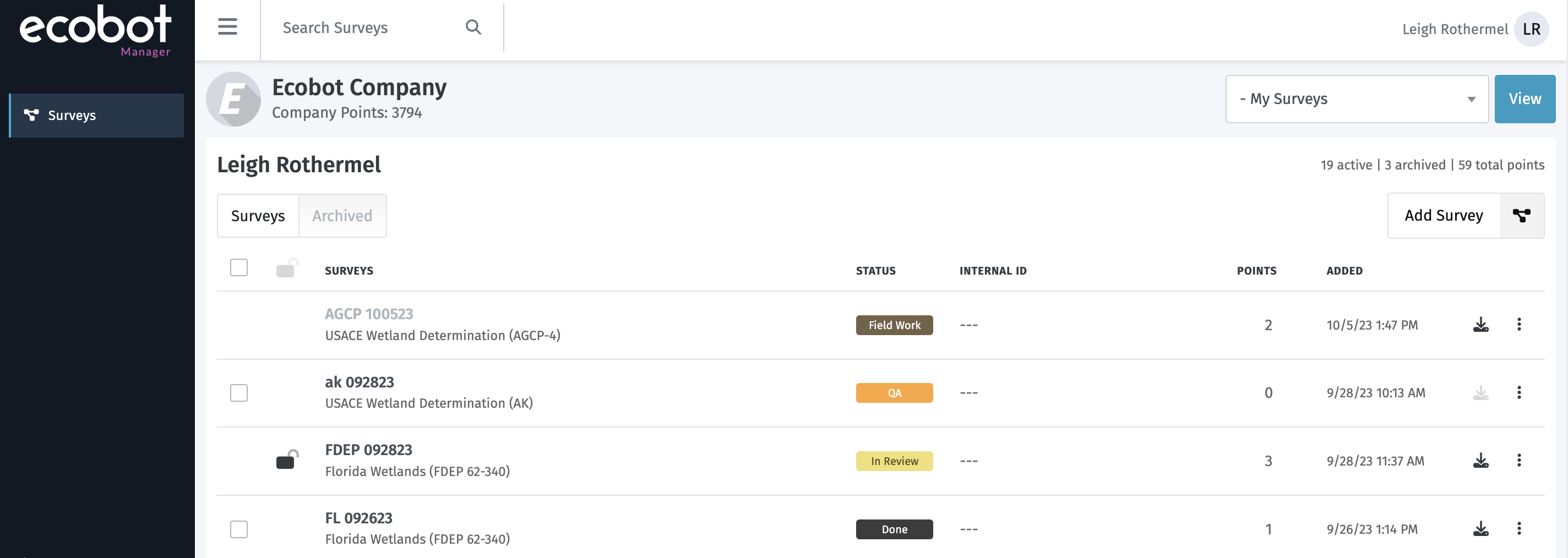
From Ecobot to ArcGIS in one export
Geodatabase, shapefile, GeoJSON. As an Esri Partner, files drop straight into your GIS workflow.
Read the how-to