
The November 2026 release follows a survey from the office to the field and back again. You upload a boundary once and it is waiting on the map when you reach the site. You map what you find as you walk, with or without signal. Back at the desk, the same features become map views you can export, the antecedent precipitation analysis runs for every point, and QA flags show what still needs a scientist's call before anything goes out the door. Everything here is on every plan, Free included.
Before you go: upload your boundaries
Upload one or more boundaries in Ecobot Manager and they're waiting for you in Ecobot Collector, drawn on the map as labeled outlines. Nobody has to pace limits off a paper exhibit, and a boundary added after fieldwork starts reaches the crew the next time the survey syncs. Manager accepts a zipped shapefile, KML, KMZ, GeoJSON, or zipped file geodatabase.
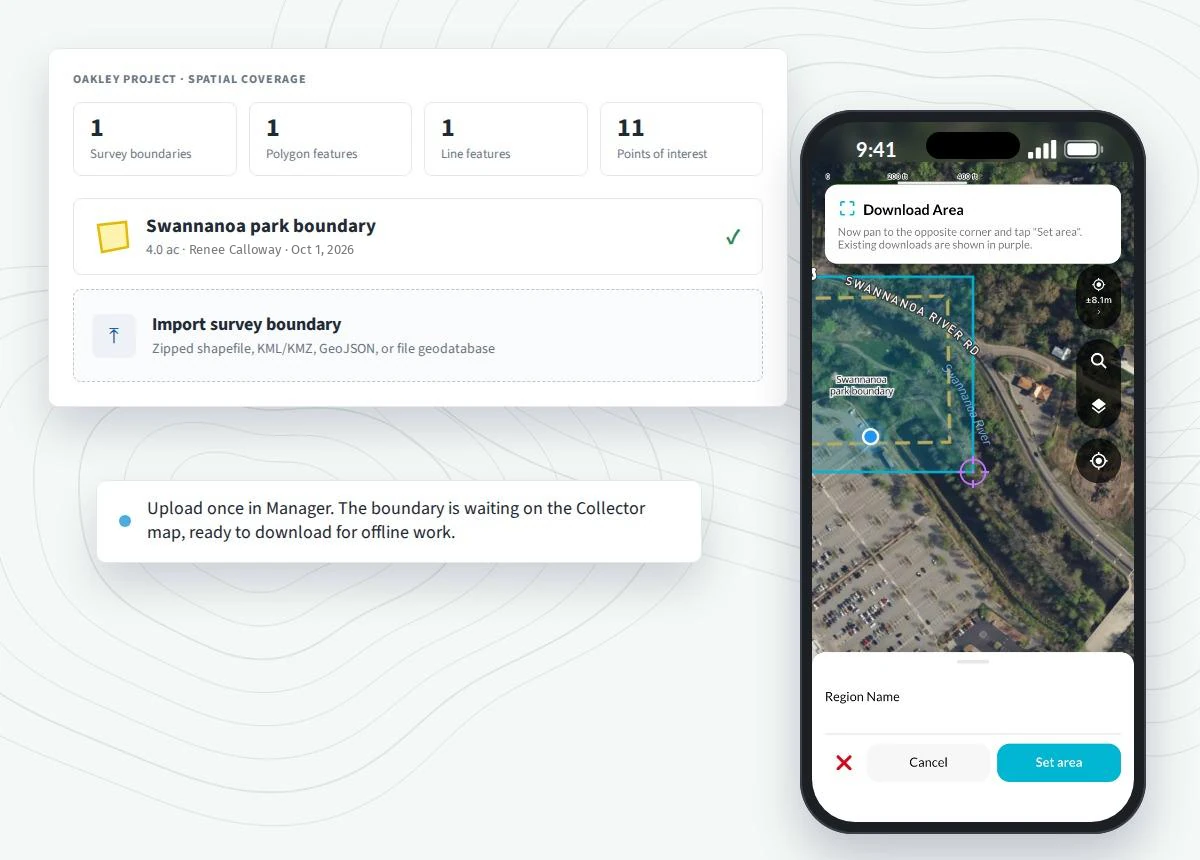
In the field: a map built for fieldwork
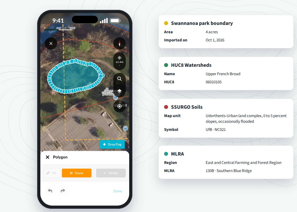
The Collector map now carries offline regions, three base maps, and the reference layers you actually use, including NWI Wetlands, HUC8 Watersheds, SSURGO Soils, MLRA, and USACE Districts. Download a region while you still have signal, and the map and every mapping tool keep working when coverage drops.
Drawing fits the way the site is walked. You can map a polygon or a line by dropping vertices, dropping flags, or streaming points as you walk the boundary, then name each feature and set its type. Points of interest and photos go on the map where you are standing, and the live location panel shows accuracy, fix quality, PDOP, and satellite count from a connected GNSS receiver.
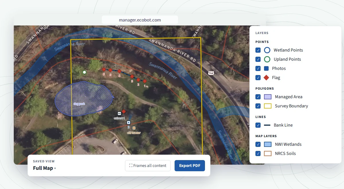
Back at the desk: Maps in Manager (Beta)
Everything mapped in Collector syncs to the survey, and Maps in Manager (in beta) is where it becomes a deliverable. Review what the team mapped, add or measure features, and choose from ten reference layers and three basemaps. Because each map saves its own layers and settings, you can build as many saved map views as the deliverable needs, such as a soils map, a site overview, and a photo map, then export each one to PDF or PNG with a legend, north arrow, scale bar, and title block.
Antecedent precipitation: APT analysis, built into Ecobot
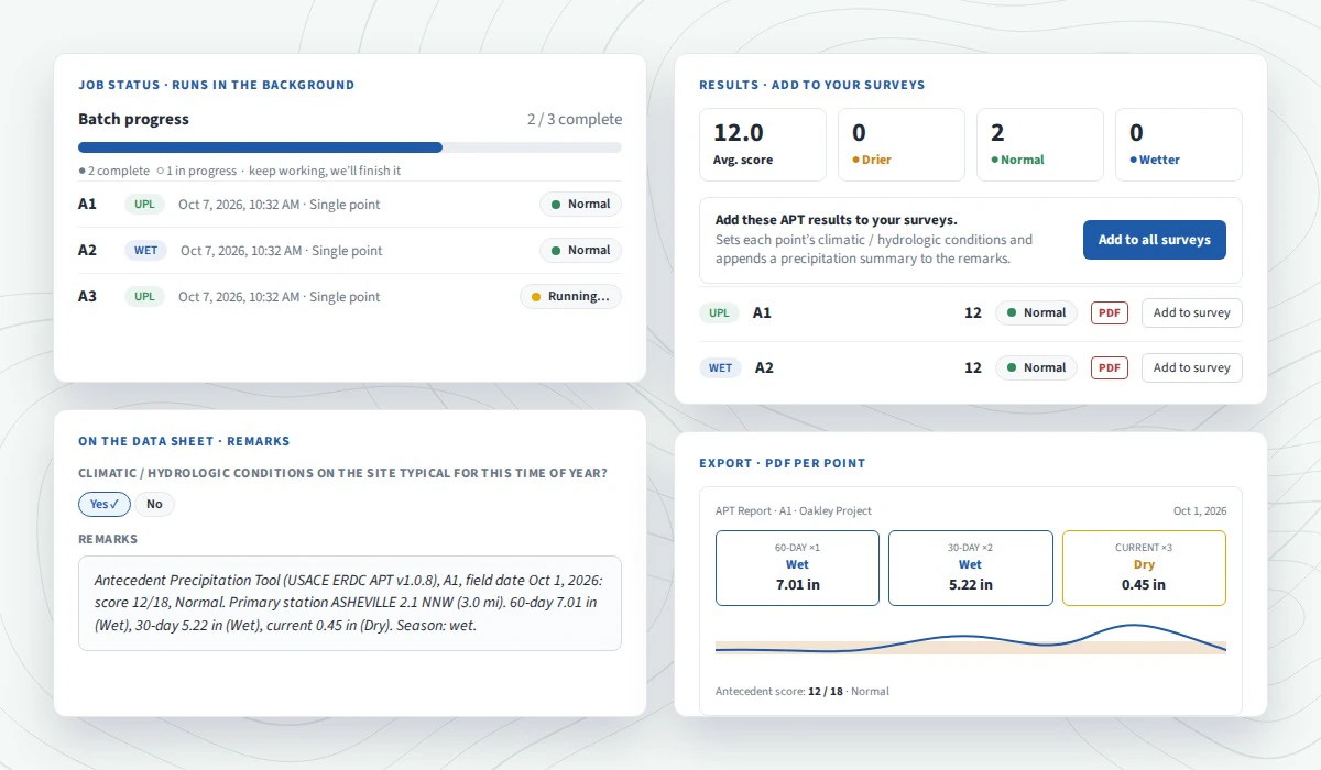
The USACE ERDC Antecedent Precipitation Tool is now part of Manager, in beta. Pick your points and Ecobot does the rest:
- It runs APT for every point on the date it was recorded.
- It produces the ERDC APT report PDF for each point.
- It pushes the results back into your survey, setting the conditions answer and adding a precipitation summary to the remarks.
- It finishes in minutes, for one point or the whole survey.
For a small site you can run a single centroid instead, and a custom point helps when the nearest weather station doesn't reflect the site.
Before it goes out the door: QA flagging
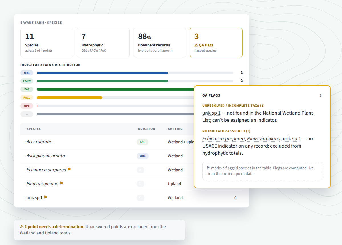
Manager now checks every survey for gaps before you deliver it. It catches what's easy to miss on a long survey, like a point with no determination or a species name that doesn't match, while you're still in Manager and can fix it. Ecobot never chooses an answer for you, so the flags show exactly where a scientist's call is still needed.
Also new: a refreshed Manager
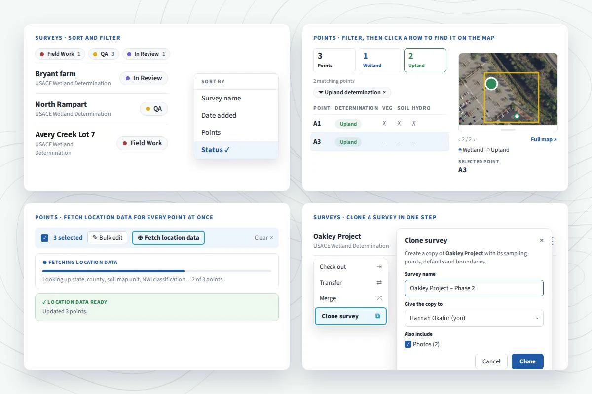
Manager has a new look, and it is faster to get around:
- Filter and sort by survey, user, point, and more.
- Click a point to find it on the map beside the list.
- Fetch location data for every point at once, and see when it's ready.
- Clone an entire survey, boundaries included, in one step.
Pricing: start free, then scale your plan
The Free plan is free forever, and you can run small projects on it for as long as you like. Survey data stays editable for 15 days from point creation, and Ecobot retains all of your historical data. Monthly plans start at $25 per seat.
Sign up free to try the release on your next survey. If you have 10 or more on your team, book a meeting with our sales team. For step-by-step help, browse the Field Guide, our knowledge base, starting with Mapping in Collector, Mapping in Ecobot Manager, and the Antecedent Precipitation Tool.