Wonderful Workflows Addressing 21st Century WOTUS Woes

Posted by Ecobot on May 10, 2022 12:00:00 AM

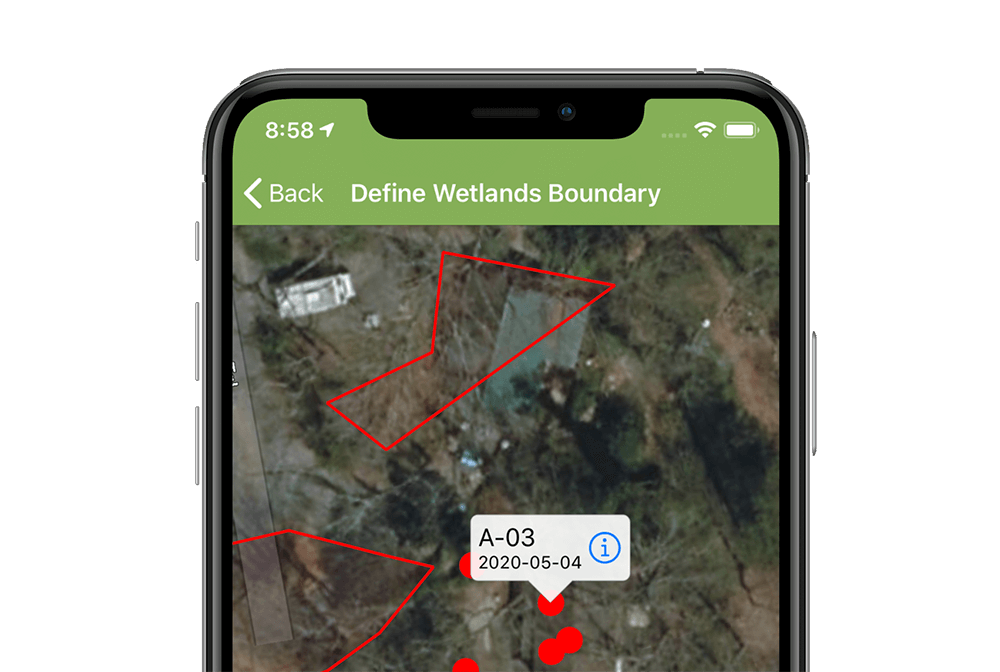
Learn about the state-of-the-art technology making field data collection more accurate and efficient and ever, leaving time and providing more robust and secure datasets for navigating the ever-evolving landscape of Waters of the United States.

This topic was covered in the 21st episode of Ecobot's webinar series, Convergence of Wetland Science and Technology. View recorded episodes here. 

Read More

Topics: Ecobot, Technology, GIS, section 404, wetland delineation, Article, Convergence of Wetland Science and Technology

Kelp Forest Monitoring & Remote Sensing

Posted by Ecobot on Apr 12, 2022 10:42:00 AM

The KelpRes project in Galway, Ireland gives a glimpse of the ecological importance of kelp forests.

This topic was covered in the 16th episode of Ecobot's webinar series, Convergence of Wetland Science and Technology. View recorded episodes here. 

Read More

Topics: Technology, Article, Biodiversity, Convergence of Wetland Science and Technology

How USFWS's IPaC Streamlines Environmental Review and Permitting

Posted by Ecobot on Mar 8, 2022 10:22:00 AM

U.S. Fish & Wildlife Service’s IPaC software makes environmental review and permitting more straightforward, efficient, and transparent than ever for the Service and users alike.

This topic was covered in the 14th episode of Ecobot's webinar series, Convergence of Wetland Science and Technology. View recorded episodes here. 

Read More

Topics: Technology, environmental permitting, natural resources, Article, Biodiversity, Convergence of Wetland Science and Technology

Updates and Future of NWI & NWCA

Posted by Ecobot on Jan 12, 2022 12:00:00 AM

The National Wetlands Inventory and the National Wetlands Condition Assessment:

What they are, how they’re used, the challenges the programs face, and what’s ahead

This topic was covered in the 18th episode of Ecobot's webinar series, Convergence of Wetland Science and Technology. View recorded episodes here. 

Read More

Topics: wetlands, Clean Water Act, Technology, section 404, Article, Convergence of Wetland Science and Technology

Ecobot Version 2: Map Wetlands Inside of Ecobot

Posted by Lee Lance on May 11, 2020 7:01:27 PM

You can now map and name multiple wetland polygons on the fly, and use the built-in map to navigate between sampling points. Instantly generate Esri ArcGIS-ready points and polygons. With no manual effort, map features collected in the field can now be dropped directly into ArcGIS Pro or into other GIS software that can import Esri shapefile formats.

One year ago, Ecobot was excited to announce our partnership with Esri. Our combined efforts are now baring fruit with enhanced offline mapping functions and ArcGIS integrations available within Ecobot's version 2 release this week.

Read More

Topics: wetlands, USACE, Technology, GIS