The National Wetlands Inventory and the National Wetlands Condition Assessment: What they are, how they’re used, the challenges the programs face, and what’s ahead
This topic was covered in the 18th episode of Ecobot’s webinar series, Convergence of Wetland Science and Technology. View recorded episodes here.
Topics
Comparison National Wetlands Inventory (NWI) and National Wetlands Condition Assessment (NWCA)
Updates to NWI and NWCA
Use cases of NWI and pushes for increased funding
Moderators
Jeremy Schewe, PWS, Chief Scientist, Ecobot
Presenters and Panelists
Megan Lang, Chief Scientist, U.S. Fish and Wildlife Service and head of NWI
Gregg Serenbetz, Environmental Protection Specialist, U.S. Environmental Protection Agency
Robb Macleod, National GIS Coordinator, Ducks Unlimited
Lindsay Reynolds, Bureau of Land Management
Gina O’Neill, Technical Consultant, Esri
Background on the National Wetland Condition Assessment (NWCA) “The NWCA is an initiative of the EPA under the Clean Water Act to conduct statistical surveys that assess and report on the ecologic conditions of the nation’s wetlands,” explains Gregg Serenbetz, MEM, Environmental Protection Specialist at the U.S. Environmental Protection Agency (EPA). “Condition is assessed by evaluating biological, physical, and chemical properties of wetlands and deriving indicators of condition based on field and lab sampling data.”
The NWCA is implemented through collaboration with state and tribal wetland agencies and federal partners. It was developed and supported in conjunction with soil scientists at the Natural Resources Conservation Survey, along with the Fish and Wildlife Service, who provided wetland maps and access to fish and wildlife refuges across the country. The EPA also worked with the National Park Service and Bureau of Land Management to identify and handpick reference sites.
Surveys are conducted at the sites every five years. The first was in 2011, followed by another in 2016, and most recently in the summer of 2021. A survey takes place across the 48 contiguous states. In 2011, special studies were conducted in Alaska’s North Slope, and in 2021 sampling was done in the Pacific Island territories, with additional sampling there slated for 2022. These surveys are one of four companion surveys under the umbrella of the EPA’s National Aquatic Resource surveys (NARS).
Key Features of the NWCA
The NWCA uses a statistically-based design that allows the results to be extrapolated to the entire population in the contiguous United States. A thousand sites are sampled each survey cycle, with 25-30% of these sampled across four successive cycles. For example, 270 sites were sampled in 2016, and those sites will be sampled again in 2021, 2026, and 2031.
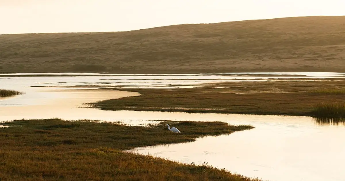
The NWCA includes tidal and non-tidal, fresh and saltwater wetlands. The sampling protocols are specifically developed to be conducted during one day in the field, which can limit the types of data that can be collected. The same protocols are conducted at all sites across the country.
To date, 1,984 wetland sites have been sampled across two survey years (2011 and 2016). The compiled field and lab data for both surveys are publicly available on the EPA’s NWCA webpage. The NWCA Survey was completed in 2021, and findings should be released in the future.
How the NWCA Uses Information from the NWI NWCA has relied extensively on the wetland mapping provided by the U.S. Fish and Wildlife Services NWI and their Status and Trends programs, using the NWI’s wetland maps to select sites in NWCA. The NWCA takes the national digital data set of all mapped wetlands in the U.S., and categorizes every wetland polygon based on their Cowardin classification codes. Cowardin is a classification system that describes certain wetland habitats based on a series of descriptors, including vegetation and hydrologic regimes.
Certain Cowardin classification codes are grouped into seven wetland categories of interest to NWCA because they meet the definition for NWCA’s target population. The definition: tidal and non-tidal wetlands within the contiguous United States, with rooted vegetation and, when present, shallow, open water less than one meter deep, which are not currently being used in the production of crops. Other Cowardin classification codes that are unlikely to be wetlands included in the NWCA target definition are grouped into five non-target categories.
Data Collection at NWCA Sites NWCA collects data on biological, chemical, and physical properties of wetlands.
Vegetation:
- Sampled in five 100 square meter plots at the sites
- Information is recorded on:
- presence and cover of each vascular plant species
- cover of all vascular species by strata
- cover of bryophytes, lichens, and algae, tree counts, and covering snags
- ground cover, considering the percent cover of water, bare ground, litter, and woody debris
Soil:
- A soil pit 125 centimeters deep is excavated
- Information recorded on soil morphology, including:
- color
- texture
- Any redoximorphic (redox) features
- Depth of the water table and hydric soil field indicators are reviewed, and soil samples are collected to measure physical and chemical properties, such as the percent sand, silt and clay, nutrients and metals.
Hydrology:
- Surface water, if present, is characterized
- Sample collected to assess for chemical properties, such as:
- pH
- Conductivity
- Nutrients dissolved
- Organic carbon
- Sulfate chloride
- Concentration of the algal toxin microcystin
- Clorophyll A
- Note*: about 2/3 of sites have water present. Water samples are taken even if there isn’t surface water present at the time of the field sampling visit.*
- Disturbances:anykind of human mediated physical alterations
- Alterations to vegetation (removal or replacement of natural wetland communities)
- Alterations to hydrology (activities that obstruct flow or relate to increases or decreases in water levels)
- Alterations to soil surface (activities that compact or harden the soil substrate or result in modifications to the surface typology of the wetland, such as sedimentation, excavation, or dredging)
- Most data is collected within a 0.5 hectare area, representing a point location specified in the survey design. Layout can be a circle, a polygon, or a boundary of the wetland if <0.5 hectares. Layout shapes are dependent on size, shape, and location of the sampling point within the wetland. Physical alteration data is taken at three 100 square meter plots on transects extending a hundred meters outward in each cardinal direction.
Findings of the NWCA and How the Data is Used Data from the two previous surveys in 2011 and 2016 have been used to develop indicators to report on the condition of wetlands at national and regional scales.
The 2011 survey found that 48% of wetland area, nationally, was in good condition based on vegetation as expressed by the vegetation multi-metric index. Physical alterations to vegetation, soil compaction, and ditching were the most prominent stressors.
- Findings from the 2016 survey are currently in preparation and should be released in 2022. The 2021 field season recently wrapped up, and is in the quality assurance stage. Once compiled, the data files will be publicly available.
Overview and Goal of the National Wetland Inventory Program “The NWI program sits within the U.S. Fish and Wildlife Service, which is the principal U.S. federal agency tasked with providing information to the American public on the extent and trends of U.S. Wetlands,” says Megan Lang, Chief Scientist at U.S. Fish and Wildlife Service. “We’re mandated to produce this data through the Emergency Wetlands Resources Act of 1986. We meet our mandate to map wetlands through production of the NWI Geospatial Dataset, and our mandate to track wetland change through provision of Wetlands Status and Trends sets are distinct, but also complementary, and together they provide critical information on wetland and deep water habitats type, location, and trends to best support a broad array of decision support needs.”
The goal of the NWI project is to provide the public and Congress with decadal reports on the extent of U.S. wetland and deep water habitats and their change over time. This information is used to measure the net results of billions of dollars worth of policy and management actions, including regulations, compensatory and voluntary restoration, and conservation, plus the effects of other change drivers.
- Overview and Uses of Status and Trends Report Data are collected for the Status and Trends reports by sampling 5,048 four-mile square plots across the contiguous U.S., regardless of land ownership. Within these plots, the Service assesses change for the study period using photos on two different dates. They then use statistical analysis to measure wetland and deep water gain, loss and type conversion.
The Status and Trend report has historically catalyzed wetland conservation, and in that way helped reduce net wetland loss. The 1984 Status and Trends report, for example, triggered the Swampbuster provision of the Food Security Act of 1985. This policy and subsequent others related to USDA policies have turned agriculture from the biggest driver of wetland loss to actually supporting wetland gain. +
The Service is in the process of collecting data to support the next report, which will be published in 2023, and will cover 2009-2019.
Overview and Uses of Wetlands Geospatial Dataset, AKA NWI Maps “The [Wetlands Geospatial Dataset, which is commonly known as NWI Maps], is our nation’s most spatially and categorically detailed information on wetlands. It is identified by the Federal Geographic Data Committee (FGDC) and the Office of Management and Budget as the ‘Wetlands layer of the National Spatial Data Infrastructure,’” says Lang. “This might sound like word soup, but what’s being implied is that the NWI dataset serves an important role within our nation’s National Spatial Data Infrastructure, which is intended to provide geospatial knowledge to understand, protect, and promote America’s national and global interests. So this is a big role for us.”
To date, it has taken approximately 40 years and $220 million in support from 165 contributors to produce the Wetlands Data Layer. Each year, between 50 and 100 million acres are updated. +
The NWI Maps website is viewed about a million times annually by members of the American public. The NWI mapper is the online portal maintained by the USFWS which is used to view the NWI geospatial datasets. The mapper is publicly accessible, and it is viewed over half a million times each year. In 2020, approximately 260,000 wetland maps were printed using the wetlands mapper, with usage like this increasing over the years.
- Due in part to the flexibility provided by its substantial categorial detail, the NWI data has been used for a variety of applications, such as:
- Assessing ecological functions and related ecosystem services, including mitigation of natural disasters, provision of clean water, modulation of hydrological flows, support for nutrient cycling, and provision of recreation
- Supporting habitat assessments and species population modeling by biologists
- Maps are heavily used in urban areas and along transportation corridors like roads, and they are also used to support decision-making in more rural areas.The NWI program does not map the proprietary jurisdiction of local state and federal governments, though NWI data is regularly used by both the government and the private sector in a supporting role to streamline the planning, permitting, and mitigation actions associated with development while conserving wetlands and their environmental benefits. The states of Minnesota and Michigan recently reported that by using NWI data to enhance the efficiency of state planning and regulatory programs, they have saved approximately $1 million and $750,000 respectively.
Funding Challenges to the NWI program The NWI project has had a flat budget for about 40 years, with the exception of a pulse of funds around 1993, and the value of that budget has declined in value due to inflation. Its primary challenge is to support a contemporary dataset on this limited budget. The Service is working to meet this challenge by leveraging partnerships and advanced technologies.
One such partnership is with the National Geospatial Program, which produces the National Hydrography Dataset (NHD). Together, the NWI and NHD are developing comprehensive, contemporary, interoperable water data to inform projects related to climate change, water quality, infrastructure development, and more. They are also modernizing and aligning all aspects of NWI and NHD data management—from planning and outreach to data standards and distributions—in order to improve dataset utility and to gain cost efficiencies.
In order to stay on the cutting edge of wetland mapping technology and standard, the NWI is adaptively managing their targeting, acquisition, and maintenance procedures to leverage the best of all data sets and techniques within a semi automated framework. This effort is called the New Mapping Technologies project, with the ultimate goal of faster, cheaper, better NWI data production. Currently, NWI’s products are created by comparing NWI data to other national land cover data sets, including NOAA’s CCAP and MRLC’s NCLD, in order to identify areas of likely wetland loss and gain since NWI data production.
Functional Comparison of the NWCA versus NWI “NWCA’s direct purpose, more than anything other than just the general conditions, is really designed to help shape policy, and how wetlands are being managed from a national level,” says Jeremy Schewe, Chief Scientist at Ecobot. “With the NWI, we’re looking at direct application for planning, for infrastructure for potential impacts or changes to the physical environment. Of course that also helps inform policy, especially since many of the datasets are being utilized to support NWCA efforts. The NWI is also directly utilized by the industry, by federal agencies, state agencies, regional agencies, and for many of you from the environmental consulting and engineering parts of this industry.”
“In the 21st century, so much depends on digital data, and that’s going to help shape the future—the future of our policy, of conservation, of responsible development and sustainable development.”
Use Cases of the NWI and the Push for Increased Funding
Ducks Unlimited
Ducks Unlimited is a nonprofit dedicated to the conservation, restoration, and management of waterfowl habitats and wetlands in the U.S.
“Ducks Unlimited has been using NWI since it started. It’s super important for us to do our conservation planning,” says Robb MacLeod, National GIS Coordinator at Ducks Unlimited. “We use it a lot in our waterfall habitats, duck energies, figuring out where the ducks are, and planning for future projects for conservation of wetlands.”
“It’s an excellent [resource] for us to use, but it’s kind of out of date…so we’re working without policy folks and others in the coalition from industry, from nonprofits, from organizations, to try and raise awareness for the NWI. We’d really like to get that $3.4 million the NWI gets every year and bump it to $15 million so we can have a complete update of the NWI in the next 10 years.”
Bureau of Land Management (BLM)
BLM is a government agency responsible for administering federal lands.
“[BLM] is interested in wetland and riparian management, and we use the NWI extensively to understand wetlands on our landscape…We’ve been involved in an initiative to help fund updated mapping our 13 western states where needed. Just like Ducks Unlimited and other folks who look at this data on large landscapes to understand the resource, we’re keenly interested in the quality of the data, and so have been involved in trying to get those updated where we work.”
NWI & Esri Partnership to Improve Predictive Modeling “The Wetland Identification Model (WIM) is a framework that’s part of the Arc Hydro toolset for predicting where wetlands are most likely to be in a landscape, given some remote sensing data,” says Gina O’Neil, technical consultant at Esri. “WIM looks at topographic factors, so those surface hydrologic drivers of wetland formation”
“We are actively developing WIM to make it a more useful tool for NWI…Specifically, how can WIM or similar predictive frameworks be used to take ancillary data for photo interpretation, and give you one distilled form of it that photo interpreters can use more efficiently, or to directly use some predicted wetland locations as a starting point to go and refine boundaries or classify wetlands?”

