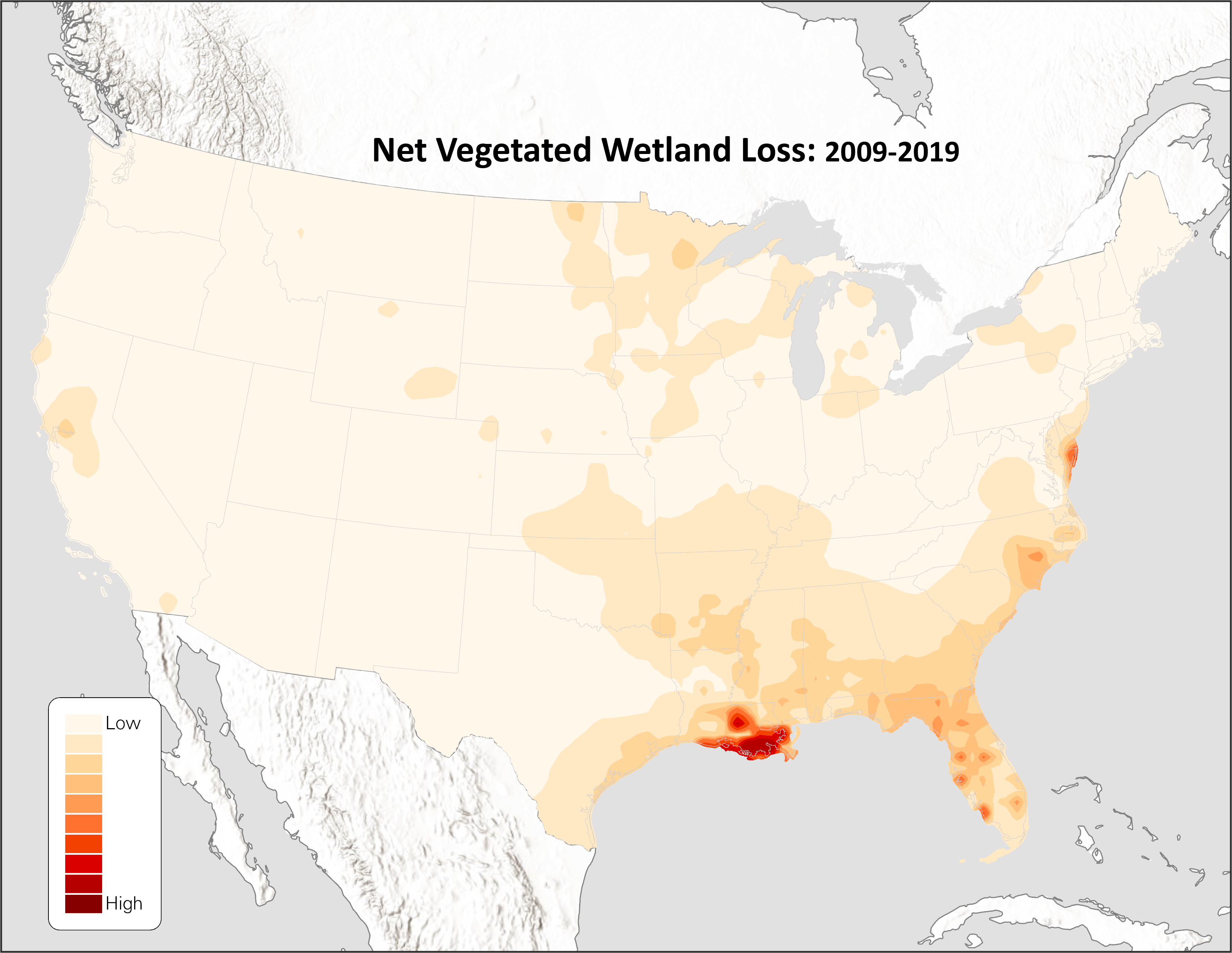
The Vanishing Wetlands: Unveiling a Decade of Change
Wetlands are precious: as vital ecosystems, hosts of biodiversity, and even as one of the planet’s largest sources of carbon storage.
Wetlands are precious: as vital ecosystems, hosts of biodiversity, and even as one of the planet’s largest sources of carbon storage.
Topics: wetlands, conservation, natural resources, Policy, Article, Biodiversity

This webinar aired on October 19, 2023 as the third installment of Esri's Environmental Regulation webinar series.
Topics: Technology, GIS, environmental permitting, wetland delineation, Video
Topics: Clean Water Act, section 404, wetland delineation, soil, Resources, Field Science
As the Climate and Lands Coordinator at The Nature Conservancy (TNC), Amy Gutierrez focuses on climate and stewardship issues in the state of Georgia. She believes that a rapid transition to clean energy could lessen the effects of climate change and protect critical biodiversity. But what about when the transition itself poses a threat to biodiversity? It doesn’t have to—and that’s where the Low Impact Solar Siting Tool comes in. At TNC, says Gutierrez, “we’re looking for win-win scenarios.”
Topics: Technology, environmental permitting, Article, Biodiversity, Ecobite

“Climate tech” includes companies working on energy, on carbon management, land use, built environments, food and agriculture, and all kinds of different industries and sectors that need to reduce emissions in order to meet our climate goals, Donnelly explained. A business journalist by trade, Donnelly joined CTVC in February 2023.
Topics: Climate Tech, Article, Ecobite