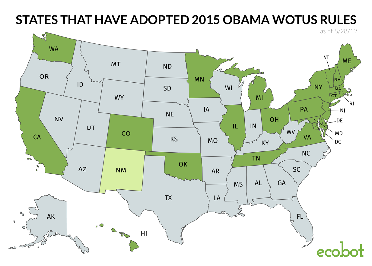
Updated on 2/17/2020: On January 23, 2020, the new WOTUS rules went into effect, limiting federal jurisdiction to wetlands that are connected via surface water, excluding ephemeral streams and isolated wetlands. With this new ruling, the US loses nearly 18% of its stream protections and as much as 50% of wetland protections. States like Nevada and Arizona lose upward of 85% of their water protections. Again, the question stands: if the impetus for this rule change is to save money and time on regulations, why is no one talking about technology?
Updated on 10/02/2019: On September 12, 2019, the US Environmental Protection Agency finalized its repeal of a 2015 Obama Rule for jurisdictional WOTUS by the federal government. This change will largely impact the 22 states where the Obama Rule has been in effect. This decision will create nationwide regulatory confusion and lawsuits. I will continue to stay abreast of the details and provide relevant updates on new publications.
As the Chief Scientific Officer of Ecobot, it is crucial that I address the pending changes to the rules of implementation of the Clean Water Act proposed by the current administration. While all regulations must be occasionally looked at in order to evolve with the times, the proposed changes, if implemented, would be a great tragedy to the both the environment and the economy of the United States. The proposed changes to the protection of “the Waters of the United States” (WOTUS) would be a major backward step in responsible progress of our country and the world at large.