Software for Efficient Wetland and Stream Assessments
Ecobot equips environmental professionals to rapidly generate accurate wetland and stream assessment reports. Automated hydric soil suggestions, AI-powered vegetation identification, streamlined QA/QC, and seamless GIS integration simplify every step—from fieldwork to final reporting.
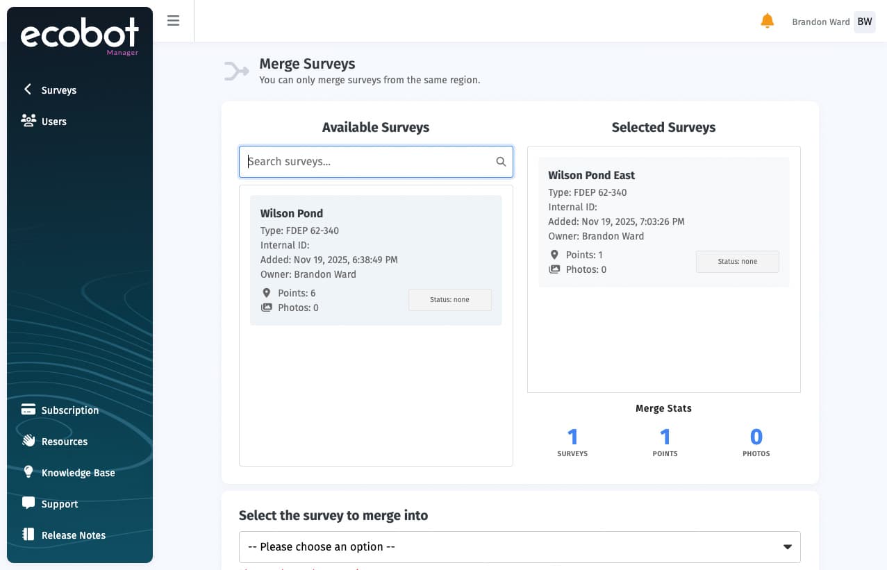
Ecobot Manager
Ecobot Manager now gives office teams faster controls for project oversight, photo review, and final deliverables.
Keep projects moving with survey merge and transfer, force check in when a device is unavailable, and role-based permissions for Admins, Managers, and Users.
Ecobot Collector
A user-friendly app enabling field scientists to gather data with efficiency and precision.
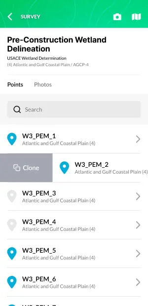
Support USACE Wetland Delineations, FDEP 62-340, Ordinary High Water Mark, NC DWQ Stream Identification, Universal Stream Assessment, and General Field Observations. The updated Manage Survey experience keeps settings, status, and newer wetland fields like Wetland Type and Wetland ID easier to update in one place.
Access information from USACE Regional Supplements, even without cell service.
Automate six location data fields in the field, including NWI and Soil Map Unit Name, based on your point coordinates. All the information you need at a glance.
Fully automated vegetation determination calculations, AI-enabled vegetation identification, and soil suggestions.
See survey progress at a glance with clearer status indicators and get alerted when data still needs to sync, so nothing gets missed before work heads back to the office.
Device naming makes it clear where a project is checked out, and automatic check in after sign out helps return fieldwork to Manager with less manual follow-up.
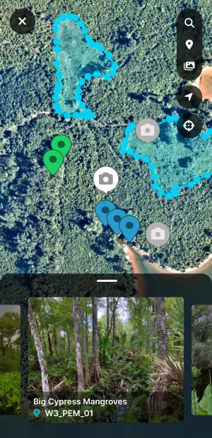
Robust Interactive Mapping. Quickly review site data and add map features.
Click color-coded map points to jump straight to survey points, features, or photos, making it faster to navigate large sites and review work already collected.
View photos in the context of your project site for quick reference and QA. Ensure all required photos have been collected and accurately associated while you're still in the field.
View and edit polygon boundaries on the map. Easily add, edit, or delete points and polygons.
Move your site data into GIS faster with geodatabase, shapefile, and GeoJSON exports that drop directly into ArcGIS and other mapping workflows.
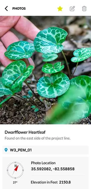
Photos, Simplified. Ecobot is the easiest end-to-end solution for taking photos in the field and producing reports.
Leverage AI to reliably identify vegetation species in the field. Potential matches include confidence data for informed decision-making.
Create polished geospatial photologs with everything you need, including point association, time and date, coordinates, direction, and project info.
Connect photos to your project with point associations and metadata like direction, time, and date.
Favorite photos to help organize them later.
Faster Results. Deliver reports more quickly and with greater accuracy for better project outcomes.
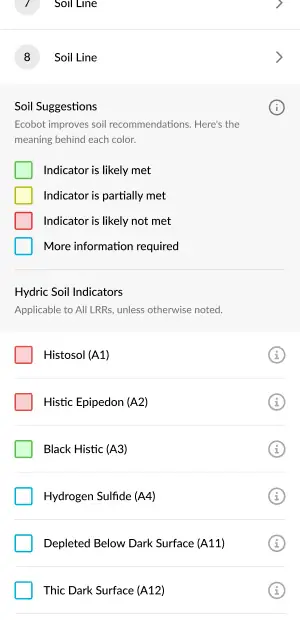
Make informed decisions about Hydric Soil Indicators with built in Soil Suggestions in the field.
Verify soil matrix entries in the field with the new matrix color swatch. Ensure entries are valid and accurate.
Automated USACE region selection based on your current location.
Search by scientific name, common name, or symbol, with regionally-specific indicator status automatically applied.
On-the-fly dominance calculations and re-sorting by descending percent cover. Clear visual feedback for passed tests.
Cloning data points makes it easy to start your next point fast on sites with repetitive properties.
Your data is secure with Ecobot.
FedRAMP Moderate security compliant.


The platform for smarter fieldwork.
The Ecobot cloud and mobile platform reduces data collection time, minimizes post-processing, facilitates data-safe collaboration, and virtually eliminates time spent on QA and report generation. Try it for Wetland Delineations, Stream Assessments, Ordinary High Water Mark assessments, and geospatial photo logs.
Questions people often ask before trying Ecobot.
Reviews
Great App
I'm very happy with this app. I estimate that when data is written by hand in a field notebook, on average 30-60 minutes is needed in the office to create electronics data sheets, proofread, edit and finalize. With Ecobot, each data sheet requires just a few minutes of office time to finalize.
Walleye65x
Apple App Store
Huge time saver!
Tons of time saved in the office. Forms are completed in the field and QA is so easy for us now. Really loving the vegetation lookup tool, as I don't always know the full name and/or correct spelling.
mariner24
Apple App Store
Just what we were looking for!
This app is exactly what we've been looking for for several years. It includes everything you need to complete efficient and accurate wetland delineations. The app is well thought out, intuitive, accurate, fast, and efficient.
EOR Iowa
Apple App Store
Faster, more accurate delineations.
Ecobot helps us speed up our delineations significantly. The built-in features allow us to quickly look up the indicator statuses of plants or to reference hydric soil indicators. Additionally, we spend far less time inputting field data after the fact because it is easy to complete all the fields at the moment. This app saves us time and helps us be more accurate and precise.
Molly L
G2
I've reduced my office work.
The improved efficiency has helped me focus on other tasks I need to do in the office. Because of Ecobot, I can instead focus on other work such as proposals, rather than wasting time typing data forms from notes.
Eric P
G2
Streamlining wetland delineations.
Using Ecobot in the field has cut down the amount of time spent in the office tremendously. The hydric soil descriptions are helping technicians be as accurate and efficient as possible in the field.
Environmental Consultant
G2
We've partnered with the companies you're already working with.
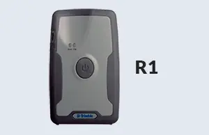
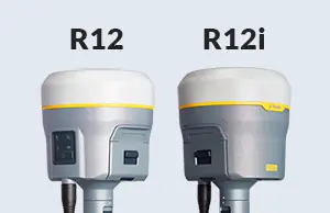
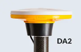
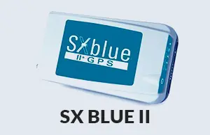
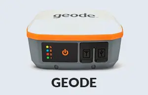
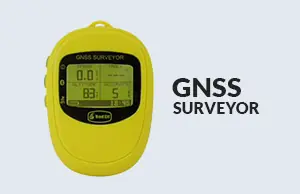
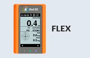
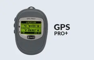
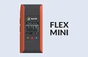
Ecobot integrates with the top industry software and hardware providers that you already know and love. Ecobot pairs with GNSS devices from Trimble, Eos Positioning Systems, Juniper Systems, Leica Geosystems, SXBlue, and Bad Elf, and supports exports of geospatial data directly to Esri's ArcGIS Online & ArcGIS Pro.
The workflow you know, taken to perfection.
Completed, accurate data forms, CSV data tables, and ArcGIS-ready shape files are created instantly upon fieldwork completion. Ecobot customers consistently find they complete their total work twice as fast, regardless of project size.
Remote Collaboration
Ecobot was built for remote collaboration between the field and the office. With full offline functionality, you're able to maintain data integrity even without cellular coverage in the field.
Eliminate Errors
Ecobot's built-in automations, reference tools, and suggestions eliminate errors and let you work with confidence.
Seamless Deliverables
Breeze through QA/QC with efficiency-boosting features, produce completed environmental reports, and seamlessly export GIS files with native Esri ArcGIS integrations.


Mobile Form Automation
Mobile Forms Automation
Mid-Market
Mobile Forms Automation
Engineered by the environmental consulting community and built in the heart of Asheville, NC.
Our award-winning platform is built on the expertise of our scientific advisors, customers and teammates. With amazing customer service and engineers dedicated to building reliable, intuitive software, Ecobot is at the forefront of innovation.


Get Updates
Industry news and platform updates.
- Privacy Policy
- Cookie Policy
- Acceptable Use Policy
- Terms & Conditions
- Security
- Cookie Preferences
- LLMs.txt
Ecobot is a cloud-based platform that optimizes data collection and management for environmental permits, supporting efficiency and accuracy during fieldwork and post-processing. Ecobot helps customers deliver data consistency across a distributed workforce and enables them to utilize data in a variety of contexts. Ecobot is used by customers at the top AEC (architectural, engineering construction) and natural resources consulting firms; by numerous counties, state and federal departments of transportation (DOT); the mitigation banking industry; and utility, energy, and oil and gas companies.
Ecobot Collector, the mobile app component of the platform, is available for iOS via the Apple App Store, and for Android devices on the Google Play Store. Ecobot is an Esri Partner.
© 2026 Ecobot, Inc. All rights reserved. Ecobot® is a registered trademark of Ecobot, Inc. Patent Pending.