At a Glance
- Client: Hollaway Environmental + Communication Services
- Project: 300-acre roadside environmental due diligence for a $11.9M detention basin
- Challenge: Deliver a wetland delineation and site profile rapidly to commence construction planning
- Solution: Ecobot Collector and Manager streamlined fieldwork and reporting
- Results:
- 10–12 hours of time saved
- Wetland delineation completed in 1.5 weeks
- Real-time updates supported U.S. Army Corps of Engineers (USACE) review
The Challenge
Texas-based Hollaway Environmental + Communication Services was enlisted by the Harris County Flood Control District (HCFCD) to perform full environmental due diligence on a 300-acre site ahead of a $11.9 million detention basin project.
The District needed a full site profile urgently to begin planning and construction, knowing mitigation credits would be necessary due to the presence of an ephemeral stream. Speed and accuracy were critical to keeping the project timeline on track.
The Approach
Using Ecobot’s Collector and Manager platforms, Hollaway streamlined both field and office workflows to deliver rapid, high-quality results.
Fieldwork with Ecobot Collector
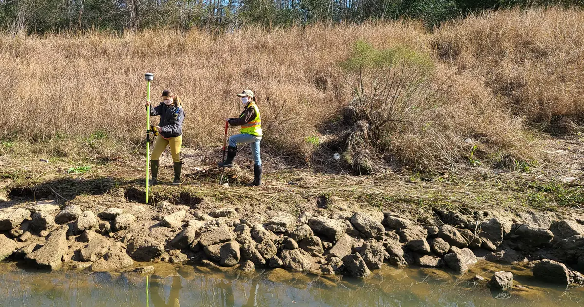
Led by Kasey Clarke, AWB, WPIT, Hollaway’s team completed a comprehensive wetland delineation in just a week and a half, surveying nearly 100 sample points across a complex site. Key time-saving features included:
- Built-In Reference Tools: Quickly confirmed diverse soil profiles on-site.
- Cloning Function: Duplicated similar sampling points, minimizing redundant data entry and speeding up fieldwork.
“Ecobot sped the process of collecting data with tools that allowed us to make accurate and efficient wetland calls. The entirely digital process reduced errors and simplified data processing.” — Molly Lenihan, Field Scientist
Office Work with Ecobot Manager
Back at the office, Clarke used Ecobot Manager to finalize the report quickly:
- Bulk Editing and Location Automation: Sampling point locations auto-populated, and bulk edits simplified QA across multiple points.
- Interactive Mapping: Enabled visualization across layers like NWI wetlands and county lines.
- Mitigation Banking Tool: Automatically generated nearby mitigation bank lists with type, status, and contact information.
“[The mitigation banking tool] is very helpful for quickly identifying potential mitigation banks within the area around the project.” — Kasey Clarke, Project Manager
The Results
Thanks to Ecobot, Hollaway delivered environmental due diligence faster and more efficiently:
- Significant Time Savings: Clarke’s team saved an estimated 10–12 hours over the course of the project.
- Faster Fieldwork: 100 sample points and various wetland types were delineated in just 1.5 weeks.
- Real-Time Updates for USACE: Months later, during regulatory review, Clarke was able to seamlessly update project data—including adding a newly emerged wetland—without duplicating fieldwork.
- Streamlined Reporting: Digital workflows enabled faster quality assurance, report preparation, and integration with mitigation banking needs.
By using Ecobot, Hollaway stayed on schedule and positioned themselves for faster regulatory approvals and greater project success.


