Learn how to complete OHWM assessments with Ecobot’s simple guide.
- Prepare for your site visit: Utilize remotely sensed data from our list of resources
- Identify key indicators: Learn to recognize and document geomorphic, vegetation, sediment, and ancillary indicators
- Apply the Weigh of Evidence approach: Use this method to make accurate and reliable determinations.
Background and purpose of OHWM Form
The U.S. Army Corps of Engineers’ jurisdiction over streams is limited to the area of water flow. The Corps published the Rapid Ordinary High Water Mark (OHWM) Field Identification Data Sheet to support the determination of jurisdictional boundaries. This process provides guidance for identifying stream boundaries by integrating scientific principles with a weight-of-evidence approach. The form’s step-by-step instructions make it a practical and accessible methodology for environmental scientists.
Similar to a wetland delineation, which demarcates the boundaries of a wetland, an Ordinary High Water Mark assessment is designed to identify the boundary of a stream for regulatory purposes.
The OHWM form and accompanying manual are designed to be particularly helpful in ambiguous situations, when there are multiple possibilities for OHWM.
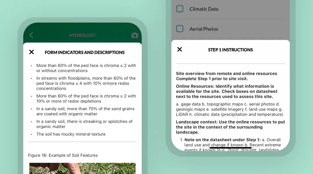
Ecobot has instructions built in to aid you during OHWM assessments.
Sign up for free to do your first OHWM assessment on Ecobot.
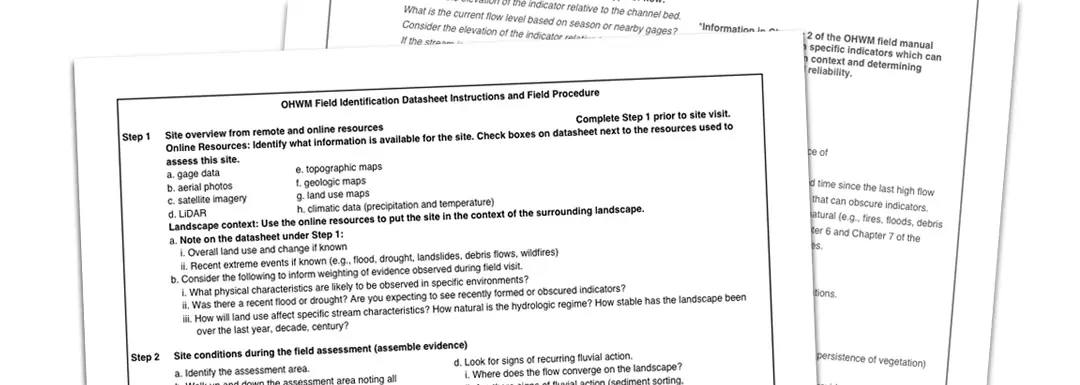
The form itself includes step-by-step instructions on the final two pages, designed to make the assessment accessible.
Step-by-Step Process to Conducting an OHWM Assessment
Before arriving at the site:
1. Site overview and landscape context from remote and online resources: Use remotely sensed data and maps to prepare background information. Provide land use context and history if possible, as well as recent weather events and historical climatic conditions within the upstream watershed. Here are some fantastic online resources to get started:
- NOAA: Aerial views, satellite imagery, LiDAR, and land use maps
- USGS: Topo maps, Gage data*
- NWS: Climate data
- NRCS: Geologic maps
*For gage data, use onsite well data if available.
At the site:
2. Site conditions during the assessment: Broadly observe and contextualize the assessment area, including the location in the landscape, connections to any bodies of water or wetlands.
3a. List evidence: List specific evidence. You’ll be tracking physical and vegetative indicators that are consistent with recurring high flows, including:
- Geomorphic indicators, like a break in bank slope;
- Vegetation indicators, like the transition from forbs and graminoids to woody shrubs;
- Sediment indicators, like changes in soil texture or development;
- Ancillary indicators, like deposits of litter.
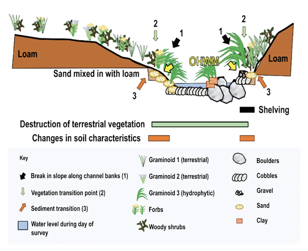
Cross section of a stream showing the identification of the OHWM. The OHWM is determined by weighing the body of evidence of four different kinds of indicators: geomorphic, vegetation, sediment, and ancillary. In this example, the physical changes labeled are (1) location of the break in slope and shelving, (2) vegetation, and (3) sediment. Sourced with permission from National Ordinary High Water Mark Field Delineation Manual for Rivers and Streams : Interim Version.
3b. Weigh Evidence: Using a Weight of Evidence approach, weigh each indicator by considering its importance based on the following: a) Relevance; b) Strength; c) Reliability. Weigh the body of evidence, and take photos of indicators.
4. Assess whether additional information is needed or other resources to support the lines of evidence observed in the field: Repeat steps 3a and 3b as necessary, and evaluate the reliability of the online sources gathered prior to the site visit. If other sources are needed, describe your rationale. Attach any remote data and analysis to the spreadsheet.
5. Describe rationale for location of the OHWM: Explain why this combination of indicators represent the OHWM and add any additional site notes to your form.
Applying Stream Assessment Methodologies to OHWM
Although the process for an OHWM assessment is consistent across regions, indicators have different significance across systems.
In certain geomorphologies, the OHWM and active channel will be in the same location. In areas with wetland presence, for example, the OHWM and active channel may be in different locations. Bankfull stage and the active channel limits are the scientific equivalents of the regulatory concept of OHWM.
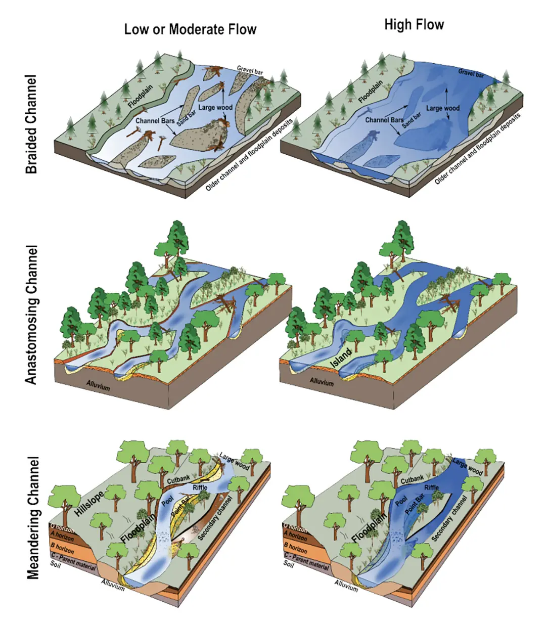
Low- and high-flow stages in braided, anastomosing, and meandering channels. The high-flow stage encompasses the active channel in each of these systems.” Sourced with permission from National Ordinary High Water Mark Field Delineation Manual for Rivers and Streams : Interim Version.
The OHWM is shaped by flows that are “well above mean annual flow but are not extreme”. 1
In what regions or environments would you conduct an Ordinary High Water Mark (OHWM) assessment?
The procedure for OHWM assessments is standardized across all United States regions but may be necessary more often in drier environments.
Completing the OHWM Form even when no OHWM is found is a way to demonstrate due diligence. We sat down with an environmental science and legal expert to learn more. See the article: Ordinary High Water Mark: A Proxy for Regulatory Certainty?
The Corps’ manual from November 2022 provides guidance on corner cases and complex or ambiguous scenarios. Access it here: National Ordinary High Water Mark Field Delineation Manual for Rivers and Streams : Final Version.
Citations:
- Eastman, J. (2022, November 29). Introduction to the interim draft of the National Ordinary High Water Mark (OHWM) field delineation manual for rivers and streams [Video]. Defense Visual Information Distribution Service. https://www.dvidshub.net/video/874184/introduction-interim-draft-national-ordinary-high-water-mark-ohwm-manual. Accessed via https://www.erdc.usace.army.mil/Media/Fact-Sheets/Fact-Sheet-Article-View/Article/486085/ordinary-high-water-mark-ohwm-research-development-and-training/.
- U.S. Army Corps of Engineers. (2022). Figure 3: Low- and high-flow stages in braided, anastomosing, and meandering channels and Figure 8: Schematic of a stream cross section showing OHWM identification. In National Ordinary High Water Mark Field Delineation Manual for Rivers and Streams (ERDC/CRREL TR-22-26) (p. 25). U.S. Army Corps of Engineers.
*This article originally focused on the 2022 Interim Draft of the National Ordinary High Water Mark Field Delineation Manual for Rivers and Streams, and has been updated to reflect the final version released in January 2025. *

