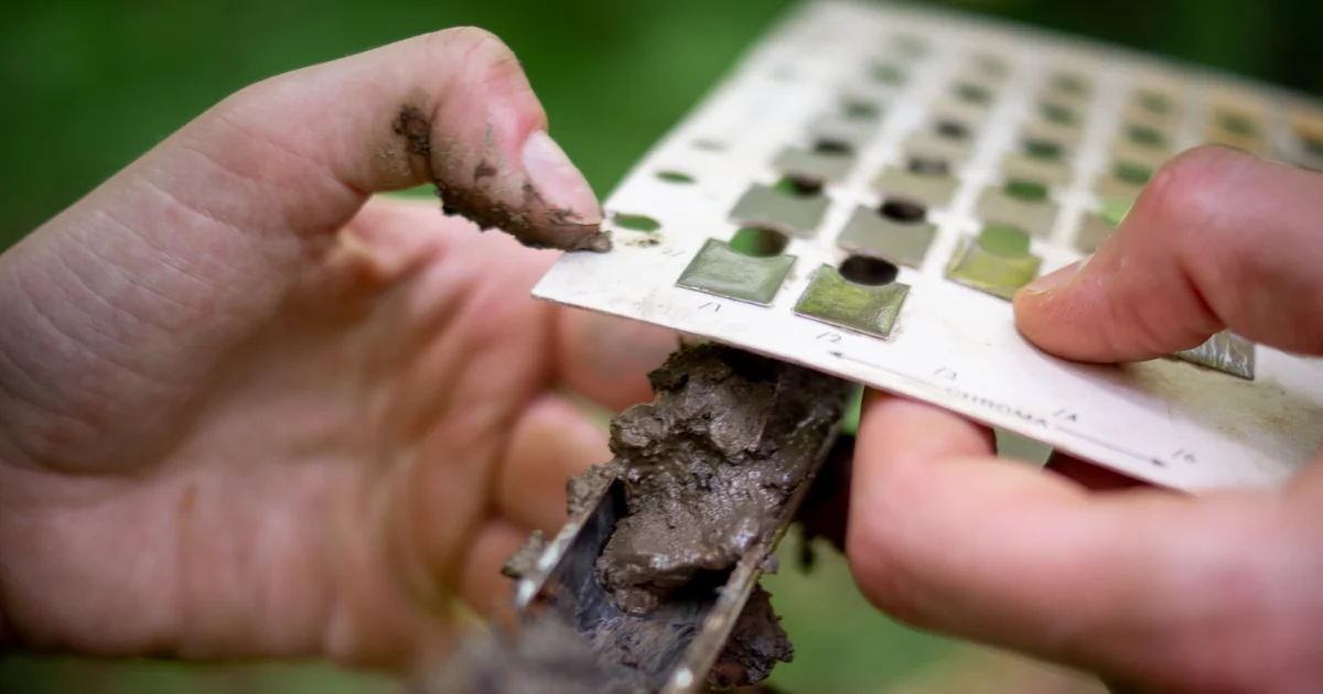
Guest post by Adam Gailey, PWS, of Gailey Environmental. Read more about the author below.
If my soil profile meets more than one indicator but I only note one, is my data sheet incorrect? I still have a hydric soil, right?
Technically, yes: as long as the selected indicator meets the hydric soil definition, the soil is hydric. However, documenting all applicable indicators provides a more complete, accurate, and defensible assessment.
Let’s use the examples below, which begin with a simple example and increase in complexity, to explain the situation a little bit better.
Example 1.
From 0-20”, we encounter very dark/black organic soil (muck), noting a strong hydrogen sulfide odor. On our datasheet, we select A4 (Hydrogen Sulfide).
A more complete selection would include both A4 and A1 (Histosol), given that texture and depth criteria are also likely met.
If we only select A4, would that make our profile non-hydric, and thus, not a wetland? No! It would still be hydric. However, we can provide a more complete answer based on texture, depth, and the conditions (i.e. saturated soil conditions for nearly all of the growing season).
It’s important to remember that more than one or a combination of indicators can be met based on this specific profile, even for different soil textures. Let’s examine this further in Example 2, and then consult the regional supplement.
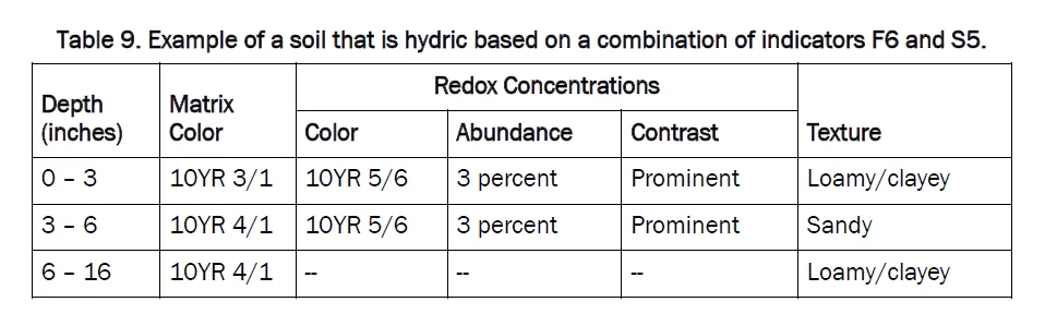
Example 2.
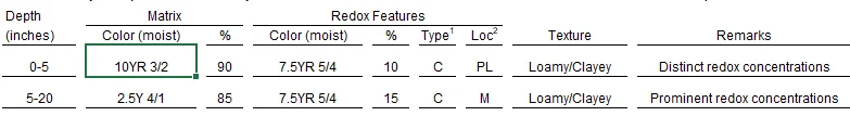
Depth 0-5” Indicators Selected: F6 Redox Dark Surface
Depth 5-20” Indicators Selected: F3 Depleted Matrix; A11 Depleted Below Dark Surface
On our datasheet, the thorough and complete answer includes all indicators that meet the definition of a hydric soil based on this profile. If we only select the first indicator, F6, from our first layer, our soil is still hydric and considered a wetland—but we want to understand the importance of why an entire profile meets, or does not meet, an indicator.
Note how the indicators change if the matrix value in the first layer changes to 3, rather than 2, as shown below:
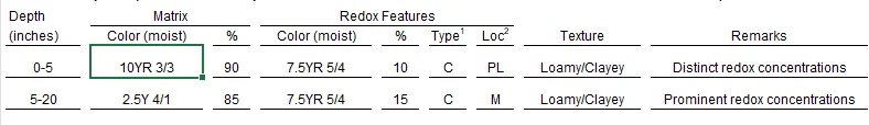
In this first layer of the profile, we wouldn’t meet the F6 Redox Dark Surface or A11 Depleted Below Surface indicators at all. The only indicator in this instance would be the F3 Depleted Matrix. The subtle difference of the matrix value completely changes the outcome.
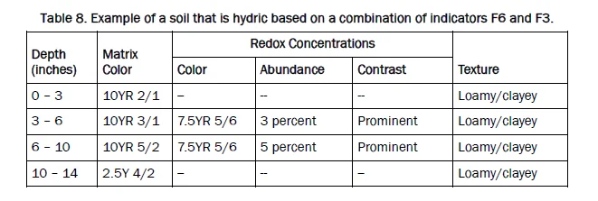
These excerpts from the Eastern Mountains and Piedmont Regional Supplement (p. 45) demonstrate how multiple indicators, or a combination of indicators across different soil textures, can apply to a given soil profile at a specific sample location:
In conclusion, it’s important to select all hydric indicators that apply.
Remember our general guiding principles for hydric soil identification:
- Color: Low chroma (≤2, Munsell).
- Texture: Loamy, clayey, sandy, or organic.
- Depth: Where indicators appear in the profile.
- Redox Features: Mottling and its relation to the matrix.
- Apply Hydric Soil Indicator Definition: Select all hydric soil indicators that apply.
Why Multiple Indicators Matter
Using multiple indicators strengthens the case for hydric soil designation. Always document all applicable indicators at the time of delineation for accuracy.
The same principle applies to hydrology indicators: If a site meets two secondary indicators (e.g., Geomorphic Position, FAC-Neutral Test) but lacks primary indicators (e.g., Water Marks, Drift Deposits, High-Water Table), the field evidence for wetland evaluation and permitting is weaker.
By checking all relevant indicators, we ensure a more defensible and scientifically sound determination of hydric soils and wetland hydrology.
About the Author:
Adam Gailey is President, Lead Scientist, and Training Instructor at Gailey Environmental. With more than 20 years of experience in the environmental consulting field, Mr. Gailey has provided scientific and regulatory expertise for natural resource assessments across the United States and Puerto Rico. He is a former president of the Mid-Atlantic Chapter of the Society of Wetland Scientists and an active member of the NAWM. Visit the Gailey Environmental Training page to learn about upcoming wetland delineation and permitting courses.

